
Habitat Bird Protection Monitoring System
Non-intrusive bird monitoring,Three-dimensional flight tracking ,Radar-cued identification,Data-driven habitat protection
Observe Without Disturbance, Protect Through Understanding
Traditional bird surveys depend on skilled observers, field access, favorable visibility, and defined observation windows. They provide valuable biological insight, but intermittent sampling can miss nocturnal activity, high-altitude movements, short migration peaks, and flight paths over open water or inaccessible terrain. Repeated entry into breeding or roosting areas may also disturb the species being studied.
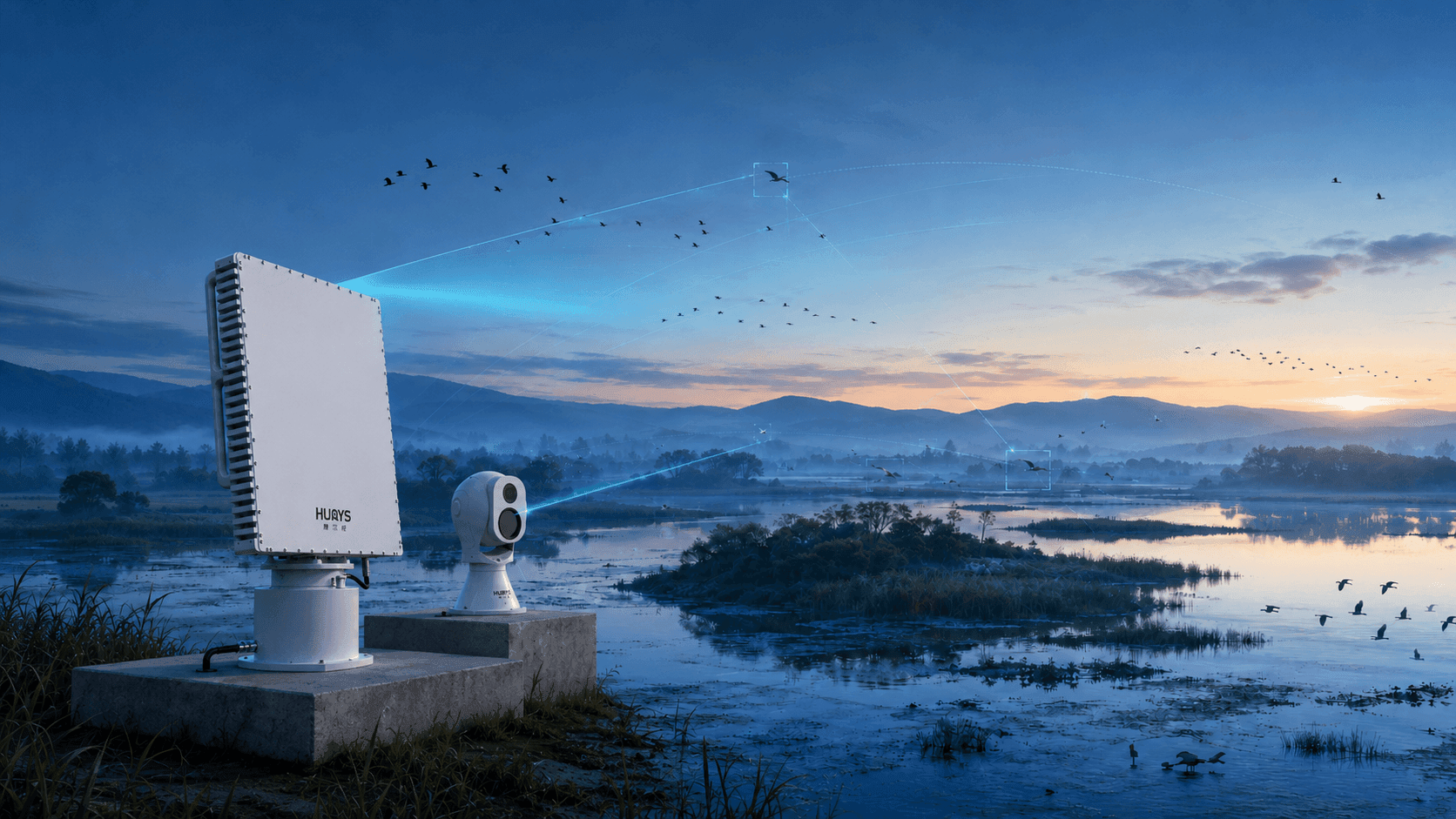
HURYS introduces a non-intrusive radar-video monitoring approach. Bird-detection radar continuously senses airborne movement and creates three-dimensional tracks without illuminating the habitat or requiring physical contact with birds. When a target or flock meets configured observation criteria, the system can direct a visible-and-thermal PTZ camera to the target coordinates for image capture and confirmation. Edge intelligence then associates track and image information, removes invalid records, and sends qualified ecological data to the platform.
This turns habitat monitoring from periodic field snapshots into a continuous evidence stream—helping researchers understand when, where, and how birds use the habitat before deciding how it should be protected.
System Architecture
The solution integrates wide-area radar sensing, radar-cued imaging, edge data processing, ecological applications, and remote-site infrastructure in a layered architecture. Wide-Area Sensing Layer — A phased-array bird-detection radar continuously scans the monitored airspace and reports target range, bearing, altitude, speed, direction, and trajectory. Detection parameters and clutter filtering are configured for the target sizes, flight behaviors, terrain, vegetation, water surface, and research objectives of the site. Visual Verification Layer — Dual-spectrum PTZ cameras provide visible and thermal imagery for radar-cued target observation. The camera automatically turns toward a selected radar track and can zoom, follow, and record the target, supporting confirmation of birds, drones, aircraft, or other observable classes. Edge Intelligence Layer — An edge computing unit associates radar tracks with video, filters unstable returns, applies target-quality rules, and performs secondary classification where suitable imagery and trained models are available. Local processing reduces unqualified data before transmission and preserves low-latency event handling. Ecological Platform Layer — The platform displays live tracks on a GIS map and organizes qualified records by location, altitude, time, direction, and target category. It generates activity heatmaps, altitude-distribution charts, temporal statistics, route animations, and event records for research and management. Remote Deployment and Alert Layer — Project-designed solar power, batteries, and 4G, microwave, or satellite communications can support suitable remote sites. Configured disturbance events can be delivered to authorized reserve personnel with location, trajectory, available imagery, and handling status. Operational flow: radar detection and tracking → target-of-interest selection → automatic camera cueing → edge data cleaning and classification → ecological data storage and analytics → disturbance alert and management response where configured.
Challenges and Applications
Habitat bird monitoring must collect scientifically useful activity data over wide and often inaccessible areas while minimizing disturbance to wildlife and separating birds from other airborne or environmental targets. Monitoring and Protection Challenges Intermittent manual observation — Field surveys capture selected periods and locations, making continuous daily, nocturnal, and seasonal activity difficult to reconstruct. Sensitive and inaccessible habitats — Wetlands, islands, mudflats, reed beds, mountains, and open water can restrict access and make repeated human observation disruptive. Darkness and reduced visibility — Night, fog, haze, backlighting, and long viewing distances limit visual-only observation. Small targets in complex clutter — Bird-sized targets may be mixed with insects, weather returns, moving vegetation, water-surface clutter, drones, or aircraft. Species and target-class ambiguity — Radar provides movement measurements but usually cannot determine species reliably without supporting imagery or biological interpretation. Large volumes of trajectory data — Research value depends on cleaning, organizing, and aggregating tracks into interpretable spatial, altitude, temporal, and seasonal patterns. Human and technological disturbance — Unauthorized drones, boats, vehicles, or visitors may disrupt feeding, nesting, breeding, or roosting areas and require timely management attention. What These Challenges Require These conditions call for continuous non-contact sensing, three-dimensional trajectory tracking, configurable observation airspace, radar-cued visible and thermal imaging, edge-based data-quality control, multi-source classification, standardized ecological records, long-term statistics, remote device management, and disturbance-event alerts. HURYS integrates these capabilities as one observation-to-conservation workflow. Typical Applications Wetlands and waterbird habitats — Measures activity over open water, mudflats, reed beds, feeding areas, and roosting zones. Nature reserves and bird sanctuaries — Builds continuous records of bird movement while reducing the need for frequent access to sensitive areas. Migration corridors and stopover sites — Analyzes flight direction, altitude, timing, intensity, and repeated movement routes during migration periods. Breeding and nesting protection zones — Monitors activity and configured disturbance events around ecologically sensitive areas. Coastal, island, and remote habitats — Supports project-designed low-power and remote-communication deployment where conventional observation is difficult. Ecological impact assessment — Provides standardized pre-construction, construction-period, or long-term operational data for trend comparison, subject to the approved study design.
Non-Intrusive, All-Weather Bird Activity Monitoring
Bird-detection radar provides continuous aerial surveillance without entering breeding, feeding, or roosting areas. It measures each qualified target or flock in three dimensions—including position, altitude, speed, direction, and trajectory—creating a time-stamped record of how birds move through and above the habitat.
Observation sectors, altitude bands, corridors, and target-quality rules can be configured around habitat boundaries and research questions. Radar maintains sensing in darkness and in conditions that reduce conventional imaging performance, while edge filtering suppresses unstable returns associated with weather, insects, moving vegetation, and water surfaces. Detection and tracking performance remain dependent on target characteristics, range, radar geometry, clutter, weather, and site design.
The result is a continuous activity baseline that reveals flight intensity, preferred routes, altitude use, directional movement, daily cycles, and seasonal change—extending rather than replacing field surveys and expert ornithological interpretation.
Radar-Cued Identification and Ecological Analytics
Radar shows where a target is and how it is moving; dual-spectrum imaging provides the visual evidence needed to interpret selected tracks. When a target of interest is detected, the system directs the associated PTZ camera to its coordinates. Visible and thermal video support confirmation of birds, flocks, drones, aircraft, or other observable targets while radar continues to maintain the trajectory.
At the edge, radar and video records are associated and checked for track quality, size and speed consistency, image availability, and classification confidence. Qualified records are stored with time, location, altitude, direction, trajectory, target category, and supporting imagery. Species or species-group identification is reported only where image quality, trained models, and expert validation support the required level of confidence.
The ecological platform aggregates these records into bird-activity heatmaps, altitude distributions, temporal curves, directional statistics, migration-route animations, and comparative reports. Researchers can examine change across hours, days, seasons, habitat zones, or study phases, while reserve managers can review configured disturbance events and their relationship to bird activity.
Problems We Solve in Habitat Bird Protection
HURYS combines non-intrusive radar sensing, radar-cued imaging, edge data-quality control, ecological analytics, and disturbance awareness to address the principal limitations of conventional habitat monitoring. Limited temporal coverage — Continuous sensing captures nocturnal activity, short migration peaks, and changes between scheduled field surveys. Blind areas over water and inaccessible terrain — Wide-area radar tracks aerial movement where direct observation or camera placement is difficult. Disturbance caused by repeated field access — Remote sensing reduces the need to enter sensitive breeding, feeding, and roosting areas solely for routine observation. Trajectories without reliable interpretation — Radar-cued visible and thermal imagery adds evidence for target confirmation and classification. Environmental clutter mixed with ecological records — Edge processing filters unstable returns and applies data-quality rules before records enter long-term analysis. Subjective or fragmented activity statistics — Standardized tracks are converted into consistent heatmaps, altitude profiles, time-series trends, and movement corridors. Delayed awareness of habitat disturbance — Configured alerts bring drones, boats, vehicles, or other supported disturbance targets to the attention of reserve personnel. Isolated studies without longitudinal continuity — A unified database supports comparison across seasons, years, habitat zones, and approved study phases. The result is broader observation coverage, cleaner ecological data, more efficient fieldwork, faster disturbance assessment, and a stronger evidence base for habitat protection and research.
HURYS Makes Habitat Bird Protection Truly “Data-Driven”
Effective conservation begins with understanding. HURYS transforms bird movement from fleeting visual observations into structured, time-stamped, three-dimensional ecological evidence—without turning the habitat itself into a source of disturbance.
Core Value: From occasional surveys to continuous activity records — Persistent sensing reveals daily, nocturnal, and seasonal movement patterns between field campaigns. From two-dimensional sightings to three-dimensional flight behavior — Position, altitude, speed, direction, and trajectory describe how birds use the airspace above a habitat. From remote detections to interpretable targets — Radar-cued visible and thermal imagery adds classification evidence to selected tracks. From raw echoes to research-quality datasets — Edge filtering, association, quality rules, and confidence fields make records more consistent and auditable. From scattered observations to ecological patterns — Heatmaps, altitude profiles, time-series curves, directional statistics, and route animations reveal habitat use at scale. From reactive protection to evidence-based management — Long-term data helps managers prioritize sensitive zones, monitoring periods, field surveys, and disturbance-response measures. By connecting non-intrusive sensing, three-dimensional tracking, visual evidence, ecological analytics, and long-term records, HURYS makes every qualified flight track part of the scientific foundation for habitat protection.