Shipborne 360° Obstacle Avoidance System
360° surrounding awareness,All-weather 4D radar sensing,Multi-radar track fusion,Intelligent collision-risk warning
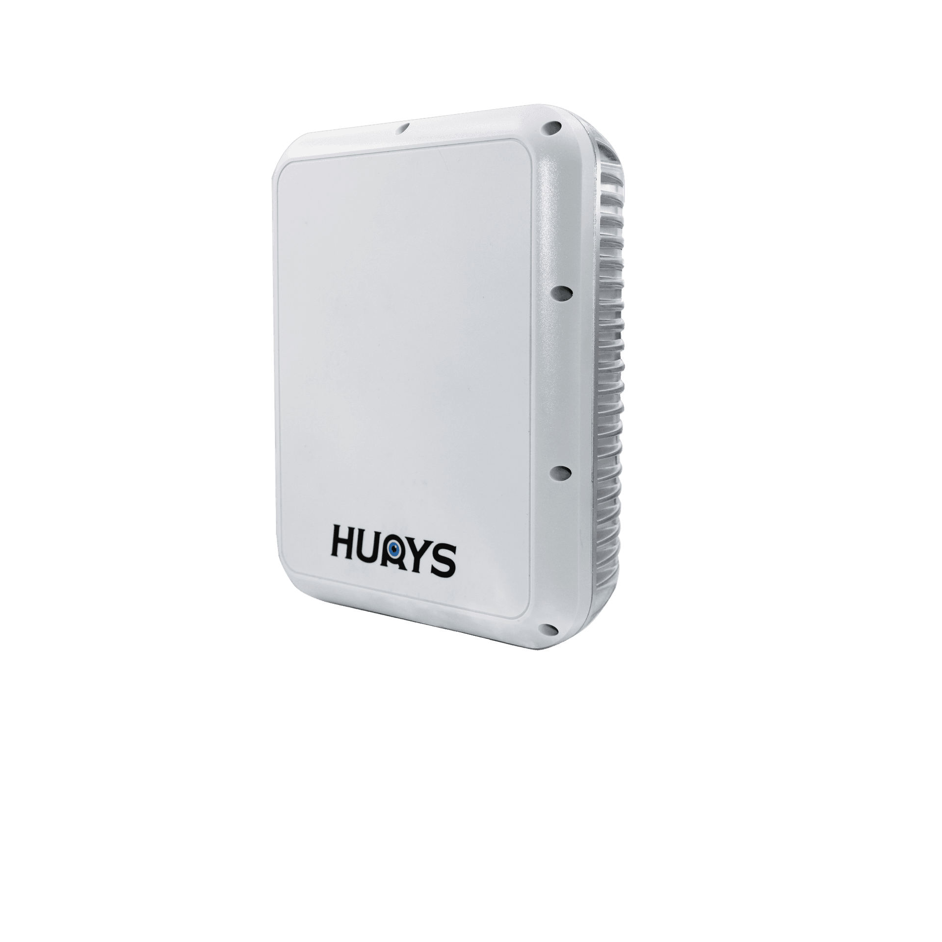
Vessel structures create blind zones around the bow, stern, and sides, while darkness, restricted visibility, heavy traffic, and non-cooperative targets make early hazard detection more difficult. The HURYS Shipborne 360° Obstacle Avoidance System deploys multiple 4D millimeter-wave radars at key positions around the vessel and fuses their tracks through an onboard edge computing unit. The system creates a unified 360° situational view, detects and tracks common surface targets, evaluates collision risk using CPA and TCPA, and delivers graded visual and audible warnings. It helps bridge crews move from fragmented, reactive observation to continuous, proactive risk awareness.
Designed as a radar-only, camera-free sensing solution, the system continuously monitors the waters surrounding the vessel without relying on lighting conditions, visual confirmation, or target-borne AIS. Multi-radar fusion maintains consistent target tracks across overlapping sectors, while the bridge display presents nearby hazards in a clear vessel-centred view. The result is earlier detection, faster risk recognition, and stronger decision support for congested waterways, berthing and manoeuvring, night navigation, and low-visibility operations.
360° Awareness, Proactive Collision Avoidance
Conventional collision avoidance depends on a combination of human watchkeeping, marine navigation radar, and AIS. Each source plays an important role, but together they can still leave gaps: human vision is affected by blind zones and visibility, AIS does not cover non-cooperative targets, and a single navigation radar may not provide the close-range, all-around detail required near the hull.
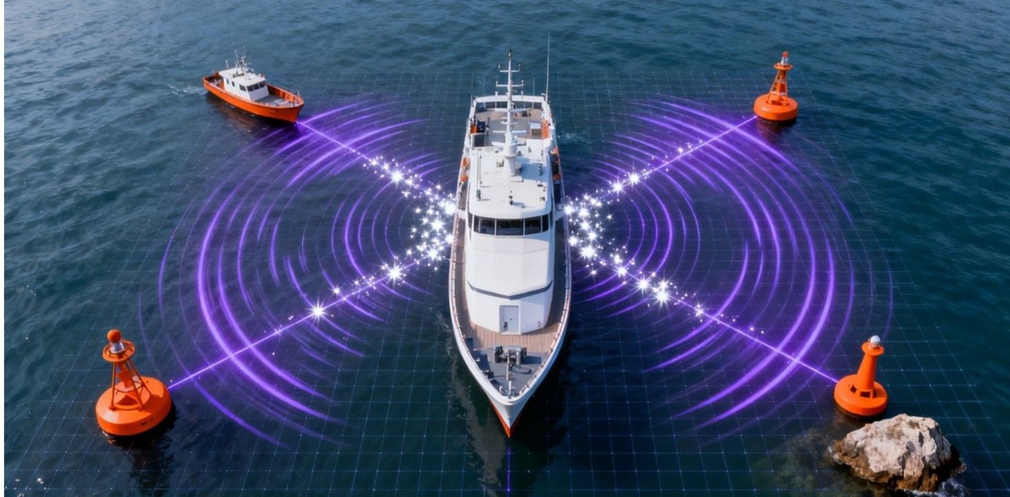
HURYS introduces a distributed 4D millimeter-wave radar approach. Multiple compact radars are installed around the vessel to create overlapping sensing sectors. Their target tracks are calibrated, associated, and stitched in a common vessel-centred coordinate system, producing a continuous 360° operating picture. The system does more than display targets: it follows their movement, evaluates potential conflicts, and warns the crew before risk becomes critical.
This transforms shipborne collision avoidance from isolated observation into an integrated process of perception, fusion, assessment, and warning—extending the crew’s situational awareness and supporting earlier, more confident navigation decisions.
System Architecture
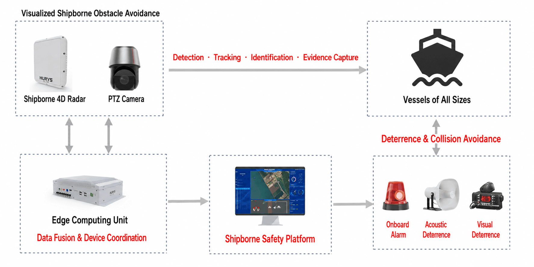
The system connects sensing, edge intelligence, risk warning, and operational review in one closed-loop architecture.
Sensing Layer — Four or more shipborne 4D millimeter-wave radars are installed at selected positions around the vessel. Overlapping fields of view reduce structural blind zones and provide continuous surrounding target data. Radar quantity and mounting positions are adapted to vessel length, superstructure, and near-field coverage requirements.
Fusion and Processing Layer — The onboard edge computing unit transforms every radar into a common vessel-centred coordinate system and performs multi-radar track association, sector stitching, persistent track-ID management, and suppression of common marine interference such as waves, spray, wake, and rain clutter.
Risk Assessment Layer — For each valid track, the system calculates bearing, distance, relative speed, movement trend, Closest Point of Approach (CPA), and Time to Closest Point of Approach (TCPA). Configurable rules identify targets that require attention and assign graded risk levels.
Application Layer — A wheelhouse display presents a 360° bird’s-eye view with risk-based target highlighting, predicted movement, and key collision parameters. Audible and visual warnings support timely crew response, while tracks and alarms can be recorded for voyage review, incident analysis, and training.
Data flow: multi-point radar sensing → coordinate calibration → track fusion and clutter filtering → CPA/TCPA assessment → graded warning and display → data recording and review.
Challenges and Applications
Shipborne collision avoidance is not simply a matter of detecting a large vessel at long range. The most demanding risks often emerge close to the vessel, where blind zones, small targets, restricted visibility, and limited reaction time occur together. Operational Challenges Structural blind zones — The bow, stern, bridge wings, deck equipment, and superstructure can block direct observation and create incomplete near-field awareness. Small and non-cooperative targets — Fishing boats, workboats, inflatable craft, buoys, and floating objects may be difficult to identify and may not transmit AIS information. Restricted visibility and continuous operation — Darkness, fog, rain, glare, and sea spray can significantly reduce the effectiveness of optical watchkeeping. Discontinuous target information — Separate sensing sectors can create duplicate or interrupted tracks unless targets are consistently associated and handed over. Experience-dependent risk judgement — In congested waters or during long watch periods, crews must rapidly determine which approaching target represents the greatest risk. What These Challenges Require These conditions call for more than an additional sensor. A practical shipborne system must provide overlapping 360° coverage, reliable detection of common small and non-cooperative surface targets, continuous track fusion across multiple radars, real-time risk assessment, intuitive graded warnings, and flexible deployment for different vessel structures. HURYS brings these requirements together in a unified radar-based solution. Typical Applications Congested or narrow waterways — Supports continuous monitoring of nearby vessels and crossing targets where manoeuvring space and reaction time are limited. Berthing, unberthing, and close-range manoeuvring — Improves awareness around the hull during low-speed operations near docks, work areas, and other vessels. Night and low-visibility navigation — Provides stable radar-based target information when visual observation is degraded. Workboats, ferries, tugs, and commercial vessels — The modular architecture can be configured around different vessel sizes, structures, and operational requirements.
All-Weather 360° Precision Sensing
Multiple 4D millimeter-wave radars form overlapping detection sectors around the vessel, reducing blind zones at the bow, stern, and sides. Unlike camera-based observation, radar does not depend on ambient lighting and can maintain continuous target sensing in darkness and in weather conditions that degrade optical visibility.
The edge computing unit converts all detections into a common coordinate system and merges overlapping observations into one consistent track. As a target moves from one radar sector to another, persistent track association maintains the same target identity, preventing duplicated or interrupted information. Temporal, Doppler, and spatial filtering are used to suppress common interference from waves, wake, spray, rain, and other unstable reflections.
The bridge crew receives a unified vessel-centred view of surrounding target position, distance, relative speed, and trajectory—providing a stable data foundation for collision-risk assessment and navigation decisions.
Intelligent Collision-Risk Warning
Seeing every nearby target is only the first step. The system must also help the crew identify which target is becoming dangerous. HURYS continuously analyses relative target motion and calculates CPA and TCPA to estimate how close a target may pass and how soon that encounter may occur.
Targets are prioritised through configurable risk thresholds. The wheelhouse interface can show bearing, range, relative speed, predicted movement, CPA, and TCPA, with safe, caution, and danger states presented through clear visual coding. When a target reaches a warning condition, the system issues audible and visual alerts indicating the threat direction and severity. The audible alarm can be acknowledged while the visual warning remains active.
By converting continuous radar tracks into clear and actionable risk information, the system reduces the time crews spend interpreting fragmented data and gives them more time to assess the situation and take appropriate action.
Problems We Solve in Shipborne Obstacle Avoidance
HURYS integrates distributed radar sensing, multi-radar fusion, risk assessment, and graded warning to address the key limitations of conventional shipborne awareness. Blind and fragmented near-field awareness — Overlapping radar deployment creates a unified 360° vessel-centred view and reduces blind zones around the hull. Late detection of small or non-cooperative targets — Radar-based sensing identifies common nearby surface targets without depending on AIS transmission or visual confirmation. Reduced visibility at night or in adverse conditions — All-weather, day-and-night radar sensing provides continuous target information when optical observation is degraded. Duplicate or interrupted tracks between sensors — Multi-radar association and persistent track IDs maintain continuous target tracking across overlapping sectors. Experience-heavy collision-risk judgement — Automated CPA/TCPA assessment and graded warnings help crews prioritise the targets that require immediate attention. High information load during complex operations — A clear bird’s-eye display converts multiple sensor outputs into one consistent and actionable operating picture. Limited evidence for review and improvement — Track and alarm recording supports voyage review, incident analysis, and operational training. The result is earlier hazard awareness, clearer risk prioritisation, reduced watchkeeping pressure, and stronger decision support across routine navigation and demanding close-range operations.
HURYS Makes Shipborne Collision Avoidance Truly “Proactive”
Traditional watchkeeping often responds after a target has already become an obvious concern. HURYS shifts collision avoidance forward in time by continuously sensing the vessel’s surroundings, maintaining unified target tracks, identifying developing conflicts, and warning the crew before risk becomes critical.
Core Value: From blind zones to 360° awareness — Distributed radar deployment builds a continuous operating picture around the vessel. From isolated detections to unified tracks — Edge fusion turns multiple radar sectors into consistent target identities and trajectories. From target display to risk understanding — CPA/TCPA analysis transforms motion data into prioritised collision-risk information. From late reaction to early warning — Configurable graded alerts give crews more time to assess and respond. From operator dependence to intelligent assistance — Continuous automated monitoring reduces information load while keeping decision authority with the crew. From one-time alarms to data-driven safety — Recorded tracks and events support review, investigation, and operational improvement. By bringing perception, fusion, assessment, warning, and review into one closed loop, HURYS turns shipborne collision avoidance from passive watchkeeping into proactive, data-driven safety.